search

VISIT

MAKE YOUR WAY HERE

at Mount Madonna, California

Directions & Maps

Getting to Mount Madonna

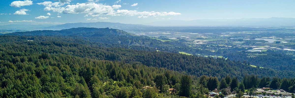
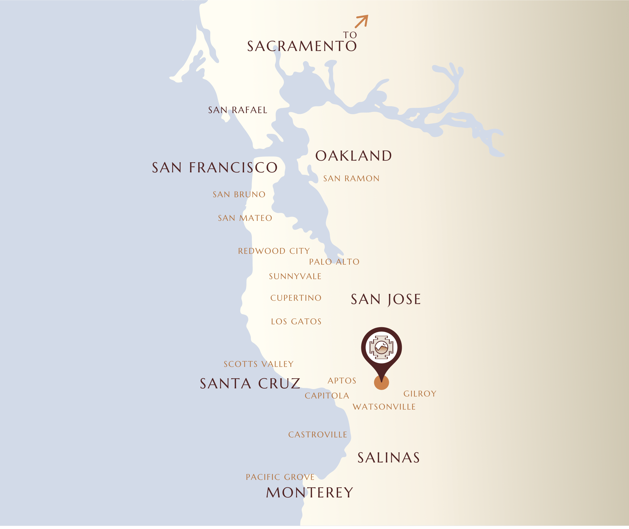
Mount Madonna Center is located in the Santa Cruz Mountains of the Central California Coast, approximately two hours driving time south of San Francisco.  Our campus overlooks the Monterey Bay, from Monterey and Pacific Grove to the south and Santa Cruz to the north. The closest commercial airport is San José Mineta International Airport with San Francisco International being the second closest. Oakland International Airport and Monterey Regional Airport are also options.
Area Map

mount madonna directions

Our Mountain Top Campus View

We are located at 445 Summit Rd., Watsonville, CA 95076. We do not recommend relying on GPS. Some online maps may route you on roads which are undeveloped and sometimes impassable. Always use Hwy 152 to get up the mountain. The directions below are the safest routes.
directions and maps mount madonna
mount madonna center icon

Get to Mount Madonna

Which Airport is Closest?

San Jose is closer than San Francisco or Oakland by approximately half an hour. Monterey Peninsula Airport is another option, but transportation from there is more complicated.

Which is the Most Direct Route?

Access to Mount Madonna from San Francisco, Oakland or San Jose is more direct through Gilroy than through Santa Cruz or Watsonville.

Does UBER/Lift come to Mount Madonna Center?

Guests have used these services on occasion, but generally these rideshare services are not consistent or reliable, as MMC is located in a rural area.

Are there door to door shuttle services?

Some of our guests have used the following shuttle services:

  • Blue Water Sedans & Limousines: (831) 477-0170. Mount Madonna has partnered with Blue Water Sedans & Limousines, a Santa Cruz based car service. Blue Water has a large fleet of vehicles, including private cars, vans, and shuttle buses, and will arrange transportation according to your needs. Ride-sharing through them is also available.
  • Atlas Express: (888) 467-0000
  • Early Bird Airporter: (831) 462-3933

Prices vary with distance and number of people traveling. Please call for prices and reservations. You can also check Yelp listings to view private shuttle services.

What are the Typical One Way Rates?

  • San Jose or Monterey Peninsula Airports.
    $50 — $120 / person, for 1-3 riders
  • San Francisco or Oakland Airports
    $70 — $150 / person for 1-3 riders

San Jose, San Francisco

From Points North on Highway 101

  1. From Highway 101 south, take the Tennant Ave exit in Morgan Hill (about 25 miles south of San Jose Airport, or 60 miles south of San Francisco Airport).
  2. Turn right onto Tennant Ave. Drive 0.2 miles.
  3. Turn left onto Butterfield Dr. Drive 0.8 miles.
  4. Continue straight onto Watsonville Rd. Drive 7.3 miles.
  5. Turn right onto CA-152 W/Hecker Pass Hwy. Continue up the mountain approximately 5 miles.
  6. At the top of the mountain, turn right into Mount Madonna County Park (Pole Line Road).
  7. Follow the yellow line through the park (2.2 miles). Do not pay the park entrance fee.
  8. When you come to the stop sign at the end of the park, continue straight on Summit Road for 1.6 miles.
  9. The Center is on the left at 445 Summit Road.

Salinas, San Luis Obispo

From Points South on Highway 101

  1. From Highway 101 north, take the Monterey Rd./Gilroy/US 101 Business exit (exit 355) in Gilroy (about 27 miles from Salinas, 150 miles from San Luis Obispo).
  2. Turn left onto Monterey Rd. Drive 1.2 miles.
  3. Turn left onto W 10th St. Drive 0.9 miles.
  4. 10th St turns slightly right and becomes Uvas Pkwy/Uvas Park Drive. Drive 0.6 miles.
  5. Turn right onto Wren Ave. Drive 0.9 miles.
  6. Turn left onto CA-152 W/1st St/Hecker Pass Hwy. Continue up the mountain approximately 8.5 miles.
  7. At the top of the mountain, turn right into Mount Madonna County Park (Pole Line Road).
  8. Follow the yellow line through the park (2.2 miles). Do not pay the park entrance fee.
  9. When you come to the stop sign at the end of the park, continue straight ahead on Summit Road for 1.6 miles.
  10. The Center is on the left at 445 Summit Road.

Santa Cruz, San Francisco

From Points North on Highway 1

  1. From Highway 1 south, take the Airport Blvd exit (exit 427) in Watsonville (about 15 miles from downtown Santa Cruz, and 90 miles from San Francisco).
  2. Turn left off the exit, and then turn left onto Airport Blvd. Drive 2.1 miles.
  3. Airport Road becomes Holohan Road when it crosses Green Valley. Drive 1.5 miles on Holohan.
  4. Turn left onto E. Lake Ave/Highway 152 E. Continue up the mountain approximately 6 miles.
  5. Just past the Mount Madonna Inn, at the top of the mountain, turn left into Mount Madonna County Park (Pole Line Road).
  6. Follow the yellow line through the park (2.2 miles). Do not pay the park entrance fee.
  7. When you come to the stop sign at the end of the park, continue straight ahead on Summit Road for 1.6 miles.
  8. The Center is on the left at 445 Summit Road.

Big Sur, Monterey, Carmel

From Points South on Highway 1

  1. Take Highway 1 north.
  2. Take the Green Valley exit (exit 426) in Watsonville (about 25 miles from Monterey).
  3. Turn right onto Green Valley. Drive 2 miles.
  4. Turn right onto Holohan Road. Drive 1.5 miles.
  5. Turn left onto E. Lake Drive/Highway 152 E. Continue straight, road becomes Hecker Pass Highway/Highway 152 E. Drive 6.3 miles.
  6. Just past the Mount Madonna Inn, at the top of the mountain, turn left into Mount Madonna County Park (Pole Line Road).
  7. Follow the yellow line through the park (2.2 miles). Do not pay the park entrance fee.
  8. When you come to the stop sign at the end of the park, continue straight ahead on Summit Road for 1.6 miles.
  9. The Center is on the left at 445 Summit Road.

More Information

Our Campus

Explore more about the beautiful Mount Madonna Campus.

THE LAND

Visit or Retreat

An inspirational and spacious mountaintop setting overlooking the Monterey Bay.

LEARN MORE

View FAQs

Find answers to some frequently asked questions.

VIEW FAQS
Close Menu

STAY CONNECTED!

* indicates required

By subscribing, you agree to our privacy policy.